
Category:Map images that should use vector graphics
Wikimedia category | |||||
| Upload media | |||||
| Instance of | |||||
|---|---|---|---|---|---|
| |||||
Images composed of simple shapes, lines, and letters such as those below should be recreated using vector graphics as an SVG file. These have a number of advantages such as making it easier for subsequent editors to edit them, enabling arbitrary scaling at high quality, and sharp high-resolution renderings for print versions. See Commons:Images for cleanup for more information.
This is a subcategory of Category:Images that should use vector graphics. You can add images to this category using the template {{Convert to SVG|map}}.
For world maps GunnMap may be a useful tool.
Maps created by precise GIS software should not generally be "recreated" with automated vector tracing software, only precise GIS software that can save in vector formats.

Subcategories
This category has the following 33 subcategories, out of 33 total.
*
-
Pages in category "Map images that should use vector graphics"
This category contains only the following page.
Media in category "Map images that should use vector graphics"
The following 200 files are in this category, out of 6,828 total.
(previous page) (next page)-
 01 géol 500k-NW.jpg 9,352 × 5,103; 4.55 MB
-
 02 géol 500k-NE.jpg 9,361 × 5,022; 2.87 MB
-
 03 géol 500k-SW.jpg 9,361 × 5,112; 3.26 MB
-
 04 Saint-Louis Dagana 200k.jpg 10,976 × 4,028; 3.31 MB
-
 05 Podor Saldé 200k.jpg 10,949 × 3,804; 3.32 MB
-
 06 Matam Semmé 200k.jpg 10,930 × 5,162; 4.21 MB
-
 10 Venezuela.png 2,000 × 1,536; 233 KB
-
 1125-1126 war.png 1,142 × 1,026; 1.91 MB
-
 1126-1130 war.png 1,142 × 1,026; 1.94 MB
-
 13szköz.jpg 800 × 595; 42 KB
-
 13szvége.jpg 800 × 595; 43 KB
-
 1500s TehuantepecIsthmus Cities.png 798 × 516; 87 KB
-
 15szeleje.jpg 800 × 595; 46 KB
-
 1646linemap.jpg 300 × 250; 19 KB
-
 1700 CE world map.PNG 4,500 × 2,234; 364 KB
-
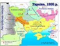 1800 Ukraine.jpg 891 × 680; 201 KB
-
 1815년 발칸 반도.png 1,000 × 1,000; 136 KB
-
 1888년과 1899년 독일령 뉴기니.png 756 × 706; 62 KB
-
.jpg/120px-1924_Cuba_hurricane_weather_map_10-19-1924_(4890122).jpg) 1924 Cuba hurricane weather map 10-19-1924 (4890122).jpg 2,048 × 1,448; 3.2 MB
1924 Cuba hurricane weather map 10-19-1924 (4890122).jpg 2,048 × 1,448; 3.2 MB
-
 1937 Provincial Elections.png 1,428 × 1,388; 127 KB
-
 1946 Indian Provincial Elections.png 1,428 × 1,388; 128 KB
-
 1948-arab-israeli-war-Dec22-jan07-detail.jpg 700 × 486; 76 KB
-
 1961 gs.png 1,855 × 1,181; 245 KB
-
 1961 ytp.png 1,843 × 1,045; 180 KB
-
 1965 gs.png 1,849 × 1,165; 251 KB
-
 1973 genel seçim.png 1,843 × 1,189; 258 KB
-
 1973 gs gp.png 1,843 × 771; 112 KB
-
 1984 Mauna Loa lava flows.gif 539 × 327; 11 KB
-
 1999-09-21 01時47分 規模7.3 earthquake.png 640 × 480; 19 KB
-
 1st Kamchatka Expedition Bergh.jpg 980 × 592; 286 KB
-
 2 digit postcode azerbaijan.png 885 × 885; 112 KB
-
 2004 Stredocesky kraj.PNG 619 × 356; 12 KB
-
 2004-ROC-LY-High.png 618 × 786; 26 KB
-
 2011 Dimos Rodou.png 2,000 × 1,253; 250 KB
-
 2011-04-06 125145.jpg 507 × 545; 104 KB
-
 2015-07-18 FahrradmitnahmeDeutschland.jpg 2,238 × 3,381; 3.07 MB
-
 2016花蓮立委各鄉鎮市得票率.png 3,138 × 2,689; 704 KB
-
 2018 ehmapka2.jpg 1,524 × 850; 139 KB
-
.png/120px-2018-06-28_Saarland_karte_(V1.11).png) 2018-06-28 Saarland karte (V1.11).png 1,634 × 1,253; 1.38 MB
2018-06-28 Saarland karte (V1.11).png 1,634 × 1,253; 1.38 MB
-
 2019 0828 UpdatedMap WhiteBackground WEB2.png 1,600 × 2,432; 1.65 MB
-
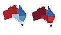 2022 Australian federal election - double map.jpg 1,033 × 606; 114 KB
-
 2022 East Timor, administrative divisions - de - colour.tif 3,344 × 1,929; 18.46 MB
-
 2023 Freedom in the World.png 4,972 × 2,517; 456 KB
-
 2023 New Map of Venezuela.jpg 820 × 938; 142 KB
-
 2023-05-29 12.01.18 copy.jpg 2,059 × 1,515; 607 KB
-
 2024 Israeli invasion of Syria.png 2,189 × 2,118; 7.4 MB
-
 2024 Taiwan Election Result Map - New Taipei Constituency 8.png 1,000 × 781; 160 KB
-
 2024 US Division 1 professional soccer teams.png 4,052 × 2,508; 2.45 MB
-
 2025 Canadian Election - Student Vote Results.png 2,338 × 1,653; 891 KB
-
 21 States of South Sudan.png 1,000 × 673; 40 KB
-
 22c196 Map1.jpg 630 × 488; 130 KB
-
 22c196 Map5.jpg 601 × 289; 65 KB
-
 22E 2015 5day.gif 895 × 716; 23 KB
-
.png/120px-24Seven-_MODIS_Fires_21-00_EDT_(26468914041).png) 24Seven- MODIS Fires 21-00 EDT (26468914041).png 1,080 × 1,080; 219 KB
24Seven- MODIS Fires 21-00 EDT (26468914041).png 1,080 × 1,080; 219 KB
-
 27 couche1a systèmes aquifères.jpg 3,510 × 4,963; 550 KB
-
 28049-Boncé-argile.png 3,057 × 2,480; 1.12 MB
-
 3republika.png 1,255 × 634; 63 KB
-
 42 couche7 biseau.jpg 2,340 × 3,309; 233 KB
-
 45 Potentiel ressources.jpg 3,509 × 4,962; 395 KB
-
 460px-Colombia-Cultura Nariño.PNG 460 × 599; 77 KB
-
 460px-Colombia-Nariño-Tumaco.PNG 461 × 599; 77 KB
-
 59017-Armentières-Sols.png 3,270 × 2,598; 5.25 MB
-
 61 Occupation du sol 50k.jpg 3,509 × 4,962; 490 KB
-
 7 Gower Swansea.png 350 × 418; 188 KB
-
 719px-CIA-FSM Micronesia-small.jpg 422 × 308; 104 KB
-
 720 Ma.png 3,814 × 1,754; 288 KB
-

-
 777px-Marlborough27s march to the Danube 1704.png 777 × 600; 159 KB
-
 800px-101115-ISAF TROOPS PER ONE BILLION GDP.jpg 800 × 364; 48 KB
-
.pdf/page1-89px-9.0_Cascadia_scenario_(median).pdf.jpg) 9.0 Cascadia scenario (median).pdf 1,168 × 1,564; 6.06 MB
9.0 Cascadia scenario (median).pdf 1,168 × 1,564; 6.06 MB
-
 901 géol 500k-NW.jpg 3,294 × 1,812; 554 KB
-
 902 géol 500k-NE.jpg 3,297 × 1,771; 490 KB
-
 903 géol 500k-SW.jpg 3,246 × 1,781; 562 KB
-
 904 Saint-Louis Dagana 200k.jpg 3,183 × 1,222; 422 KB
-
 905 Podor Saldé 200k.jpg 3,167 × 1,192; 423 KB
-
 906 Matam Semmé 200k.jpg 3,157 × 1,542; 547 KB
-
.jpg/120px-A_-_Glacial_Lake_Tight_(Ohio_Geology_Newsletter%2C_1987).jpg) A - Glacial Lake Tight (Ohio Geology Newsletter, 1987).jpg 1,726 × 1,637; 203 KB
A - Glacial Lake Tight (Ohio Geology Newsletter, 1987).jpg 1,726 × 1,637; 203 KB
-
 A Magyar Királyság a 14. század közepén.JPG 800 × 595; 51 KB
-
 A map published in 1820, Hampi, Vijayanagara ruins.jpg 957 × 712; 205 KB
-
 A Mexikói-völgy 1519-ben.png 1,330 × 1,794; 1.25 MB
-
 A Tapestry of Chaos - Europe in 1919.pdf 2,550 × 1,650; 1.3 MB
-
 A Weser watershed closer.gif 370 × 563; 9 KB
-
.png/120px-A19_road_(Tanzania).png) A19 road (Tanzania).png 1,215 × 474; 1.05 MB
A19 road (Tanzania).png 1,215 × 474; 1.05 MB
-
 A49 OSM.jpg 945 × 1,417; 582 KB
-
 Aa and connecting waterways.jpg 500 × 556; 167 KB
-
 AA EastEngla.jpg 1,033 × 867; 326 KB
-
 AA587Events.jpg 2,574 × 2,367; 3.36 MB
-
 AADerenRice.jpg 1,152 × 1,160; 460 KB
-
 Aaker central europa.png 805 × 553; 26 KB
-
 Abaeté River.PNG 823 × 704; 1.11 MB
-
 ABB range.jpg 825 × 600; 301 KB
-
 Abbayes du massif vosgien.jpg 1,747 × 2,037; 896 KB
-
 Aberystwyth-wards-map2.png 582 × 860; 114 KB
-

-
 Achaemenid Empire 500 BC.png 3,070 × 1,637; 811 KB
-
 Achaemenid Empire 500 BCE.jpg 3,070 × 1,637; 1.69 MB
-
 Achaemenid Empire at its greatest extent according to Oxford Atlas of World History 2002.jpg 3,000 × 2,250; 1.71 MB
-
 Adenanthos cuneatus map.png 699 × 936; 37 KB
-
 Admin-St-Vinc.JPG 295 × 530; 11 KB
-
 Administrative Division Beihai.png 2,060 × 2,440; 306 KB
-
 Administrative Divisions of Azad Kashmir.jpg 825 × 1,102; 196 KB
-
 Administrative Divisions of Balochistan.jpg 1,100 × 825; 239 KB
-
 Administrative Divisions of NWFP.jpg 833 × 1,103; 295 KB
-
 Administrative Divisions of Punjab.jpg 821 × 1,102; 310 KB
-
 Administrative Divisions of Sindh.jpg 830 × 1,105; 268 KB
-
 Administrative map of Andhra Pradesh with RTO codes for vehicle registration.png 1,886 × 1,933; 524 KB
-
 AdministrativeDivisionOfMacao-German.png 600 × 811; 155 KB
-
 Admission USA 2017.png 1,354 × 624; 43 KB
-
 Advance S France.jpg 269 × 700; 97 KB
-
 Adygea.png 731 × 635; 37 KB
-
 Adygejsko.png 731 × 635; 115 KB
-
 Aegean Sea with island groups labeled.gif 350 × 465; 20 KB
-
 Aegotheles savesi range.png 668 × 599; 127 KB
-
 Aenderungen Obus O30 1966.png 1,216 × 1,107; 568 KB
-
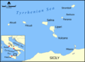 Aeolian Islands map.png 800 × 589; 144 KB
-
 Aerial-herbicide-spray-missions-in-Southern-Vietnam--1965-1971.jpg 1,262 × 1,628; 225 KB
-
 Afghanistan-Konar.png 300 × 230; 9 KB
-
.jpg/120px-AFoCO_Members_(Aug_2020).jpg) AFoCO Members (Aug 2020).jpg 4,182 × 2,775; 1.22 MB
AFoCO Members (Aug 2020).jpg 4,182 × 2,775; 1.22 MB
-
 Afrique latine1.png 360 × 392; 15 KB
-
 Aghuank.jpg 1,512 × 944; 430 KB
-
.jpg/120px-Ahe_Atoll_-_EVS_Precision_Map_(1-100%2C000).jpg) Ahe Atoll - EVS Precision Map (1-100,000).jpg 1,266 × 877; 79 KB
Ahe Atoll - EVS Precision Map (1-100,000).jpg 1,266 × 877; 79 KB
-
 Ahtum sermon01.png 1,019 × 750; 75 KB
-
 Ahunui Map.jpg 1,240 × 902; 212 KB
-
 Aiguilles Limite communale.jpg 956 × 577; 113 KB
-
 Aitutaki Atoll map.jpg 1,240 × 902; 236 KB
-
 AJC-Cable-route.png 276 × 414; 15 KB
-
 Akiaki Island - Map.jpg 1,240 × 902; 111 KB
-
 Akragas406.PNG 466 × 569; 51 KB
-
 Al-Mukharram blank subdistricts 2013.png 538 × 380; 7 KB
-
 AL-patotenilo.png 330 × 500; 5 KB
-
 Alabama POI.png 334 × 532; 13 KB
-
 AlaCounties.png 518 × 800; 31 KB
-
 Alagoas Municipalities.png 1,252 × 700; 30 KB
-
 Alan kingdom hispania.png 1,066 × 786; 77 KB
-
 Alaska boundary dispute.jpg 1,184 × 1,096; 438 KB
-
 Alaska earthquakes.jpg 976 × 620; 162 KB
-
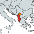 Albania-Kosovo.png 1,029 × 1,028; 318 KB
-
 Albaniandialects.png 2,908 × 4,506; 233 KB
-
 Albanischer Sprachraum.PNG 442 × 544; 32 KB
-
 Albano diocesi.png 1,282 × 1,760; 125 KB
-
 Alboran-2260027926 9be0b3f1eb o.jpg 1,240 × 904; 204 KB
-
 Aleutian Islands map.png 1,160 × 691; 119 KB
-
 Alfios.png 1,200 × 940; 1.15 MB
-
 Algeria CIA map.png 326 × 350; 10 KB
-
 Alleenstrasse.png 188 × 235; 7 KB
-
 Aller Flusssystem topo.png 1,974 × 2,703; 7.54 MB
-
 Alm signs+consts.jpg 5,742 × 773; 355 KB
-
 Alpenstrasse.png 188 × 235; 6 KB
-
 Alsace topo.png 1,475 × 2,148; 5.37 MB
-
 Altazin-pos.png 632 × 600; 148 KB
-
 Altona-Kieler Eisenbahn Karte.png 1,000 × 600; 573 KB
-
 AMAGER ISLAND.JPG 656 × 805; 61 KB
-
 Amazon River headwaters map.jpg 2,337 × 1,675; 1.12 MB
-
 Amazonian Manatee.png 212 × 319; 9 KB
-
 Ambelau.png 1,188 × 592; 780 KB
-
 Amber Road.jpg 2,247 × 3,276; 1.27 MB
-
 American Samoa Districts.png 2,112 × 1,632; 36 KB
-
 American Samoa villages.png 2,112 × 1,632; 69 KB
-
 Ammer RFakler.jpg 1,000 × 595; 87 KB
-
 Amtrak Empire Builder.jpg 1,200 × 415; 136 KB
-
 Amundsen Coast map.png 562 × 575; 50 KB
-
 Amurrivermap.png 989 × 779; 352 KB
-
 Anacapa-island-nps-map.PNG 603 × 266; 9 KB
-
 Anatolia anciana.png 713 × 401; 51 KB
-
 ANCSA Regional Corporations Map.jpg 1,100 × 816; 83 KB
-
 AndalusAndMorocco.png 180 × 180; 42 KB
-
.jpg/120px-Andaman_languages_(blank).jpg) Andaman languages (blank).jpg 822 × 594; 80 KB
Andaman languages (blank).jpg 822 × 594; 80 KB
-
 Andamanais-negritos-carte.png 737 × 567; 34 KB
-
 Andhra Pradesh and Telangana Physical.jpeg 2,598 × 2,244; 796 KB
-
 Andhra Pradesh and Telangana.png 909 × 867; 53 KB
-
 Andhra Pradesh deu.png 842 × 777; 1.03 MB
-
 Andhra Pradesh topo leer.png 842 × 777; 1.03 MB
-
 Andorramap.png 800 × 650; 115 KB
-
 Androscoggin watershed.png 300 × 277; 59 KB
-
 Angara.png 479 × 734; 24 KB
-
_Limite_communale.jpg/120px-Angles_(Vendée)_Limite_communale.jpg) Angles (Vendée) Limite communale.jpg 954 × 575; 127 KB
Angles (Vendée) Limite communale.jpg 954 × 575; 127 KB
-
 Anglo-Scottish.border.modern.png 600 × 592; 586 KB
-
 Angola unita.png 326 × 351; 22 KB
-
 AniMap.gif 700 × 693; 97 KB
-
 Animated map of Alexander's route, c.334-325 BCE.gif 406 × 178; 8 KB
-

-
 AnLoc Map.png 512 × 599; 138 KB
-
 ANNID.png 950 × 570; 44 KB
-
 Ant hypso.png 737 × 620; 82 KB
-
 Antarctic Circumpolar Current.png 429 × 391; 242 KB
-
 Antarctica-Region.png 874 × 874; 550 KB
-
 Anteil Russlanddeutsche.png 2,000 × 1,212; 276 KB
-
 Antilles current.jpg 500 × 275; 63 KB
-
 Antiochia su Oronte.PNG 1,628 × 1,976; 56 KB
-
 Anuanuraro Map.jpg 1,240 × 902; 232 KB
-
 Anuanurunga Map.jpg 1,240 × 902; 151 KB
-
 Apalachicola watershed.png 300 × 278; 102 KB
-
.jpg/120px-Apataki_Atoll_FP_-_EVS_Precision_Map_from_Landsat_S-06-15_2000_(1-225%2C000).jpg) Apataki Atoll FP - EVS Precision Map from Landsat S-06-15 2000 (1-225,000).jpg 1,255 × 877; 155 KB
Apataki Atoll FP - EVS Precision Map from Landsat S-06-15 2000 (1-225,000).jpg 1,255 × 877; 155 KB
-
 Apollo-Cable-route.png 370 × 118; 9 KB
-
 ApproximatebordersAlashAutonomy.png 1,400 × 1,108; 90 KB
-
 April 27, 1971 tornadoes in Kentucky.png 913 × 820; 48 KB
-
 Apuseni in Romania.jpg 917 × 574; 244 KB
-
 Apuseni Skizze Gliederung.jpg 613 × 589; 86 KB
-
 Apuspacificuspacificus.png 847 × 1,050; 163 KB
-
 Aq-map.png 331 × 355; 5 KB


.jpg)


.png)


.png)


.jpg)


.jpg)


.jpg)


_Limite_communale.jpg)


.jpg)


.png)
.jpg)